
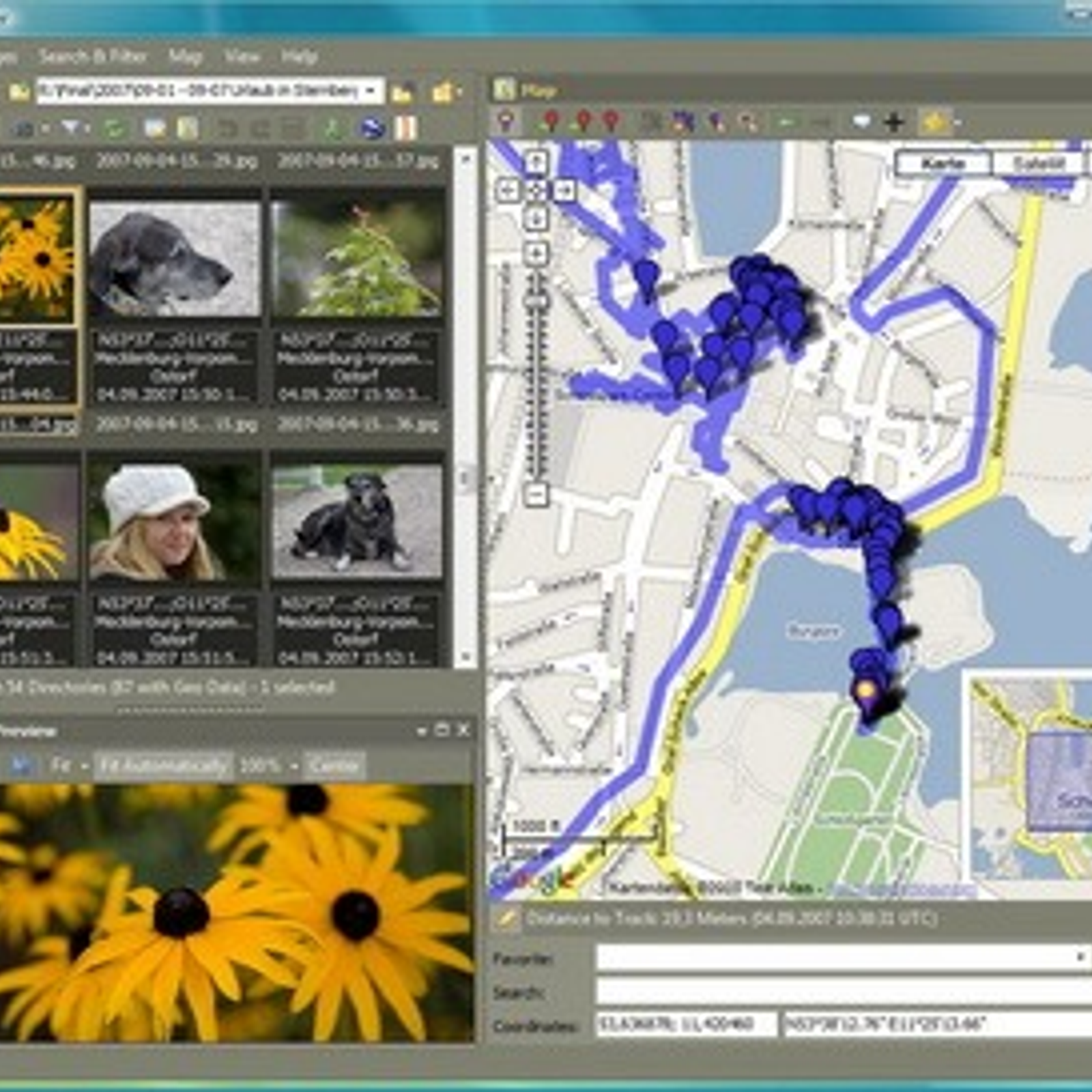
Geosetter is a free photo and graphics application that allows users to view, edit and manage geotags and other metadata associated with digital images. It enables users to quickly and easily add, edit, delete and manage location-based information, such as geotags, to their digital photos and images. Geosetter also provides a variety of tools for analyzing and visualizing the geographic information associated with digital images, including support for Google Maps, OpenStreetMap and other mapping services. Geosetter enables users to assign and store geographic information directly from photos, or by manually entering latitude and longitude coordinates. The application also offers a variety of features for creating and managing photo albums, as well as for sharing photos with friends and family.


 Geotag
 Pictomio
 GeoTag
 Houdahgeo
 GeoImgr.com
 GPSPhotoLinker
Discontinued The program is no longer updated. The latest version, 1.2 build 35, released in March 2012, can still be downloaded from the official website.